The Atlas Mountains run for some 2,500 kilometres across North Africa, and the highest, wildest and most walkable stretch of them lies in Morocco. They begin less than an hour from the walls of Marrakech and rise to 4,167 metres at Jebel Toubkal, the highest summit in North Africa. Between the two sit terraced villages, walnut groves, mule paths older than any road, transhumant shepherds, snow into late spring, and some of the most generous hospitality in the country.
This guide is written for travellers deciding what the Atlas should be in their trip: a half-day escape from the city, a two-day valley walk, a serious summit climb, or simply the mountain crossing on the way to the desert. It covers the three ranges, the main trekking regions, the Toubkal ascent, day trips from Marrakech, seasons, fitness, what to pack, how guides and mules work, altitude, culture and responsible walking — plus the honest answers travellers actually ask us before they book.
The three Atlas ranges, explained simply
Almost every confusion about the Atlas disappears once you know there are three distinct ranges in Morocco, each with a different character.
The High Atlas
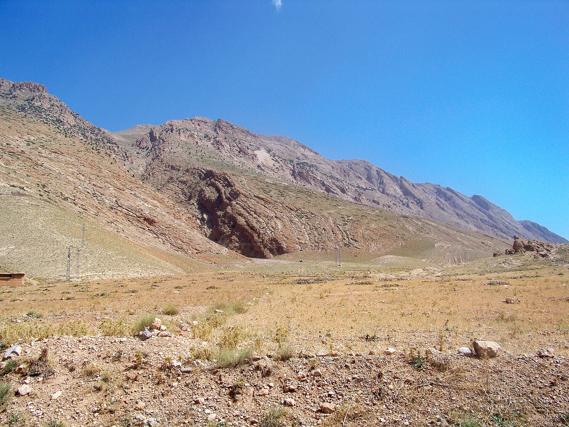
The dramatic one, and the range most people mean when they say "the Atlas". It runs roughly south-west to north-east from the Atlantic near Agadir to the Moulouya valley, forming the wall between Marrakech and the Sahara. This is where Toubkal stands, where the great trekking valleys are — Imlil, Aït Bouguemez, the M'Goun massif, the Tessaout — and where the two famous road passes cross: Tizi n'Tichka on the way to Ouarzazate, and Tizi n'Test on the way to Taroudant. Snow lies on the high ridges from roughly December to April, and in a strong winter much later.
The Middle Atlas
Gentler, greener and far less visited. North-east of the High Atlas, around Ifrane, Azrou and Khenifra, it is a plateau country of cedar forest, Barbary macaques, volcanic lakes and cool alpine-feeling towns. Travellers usually meet it on the road between Fes and the desert, and it is a revelation in summer, when it stays cool while the rest of Morocco bakes.
The Anti-Atlas
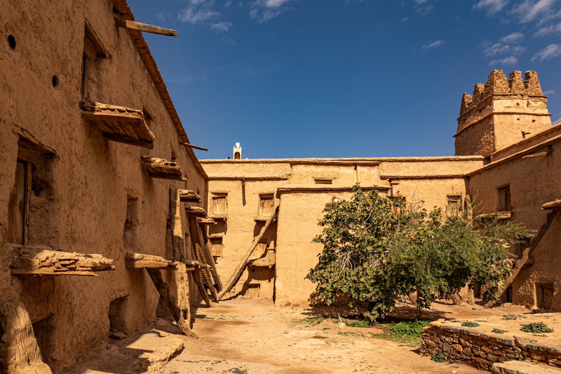
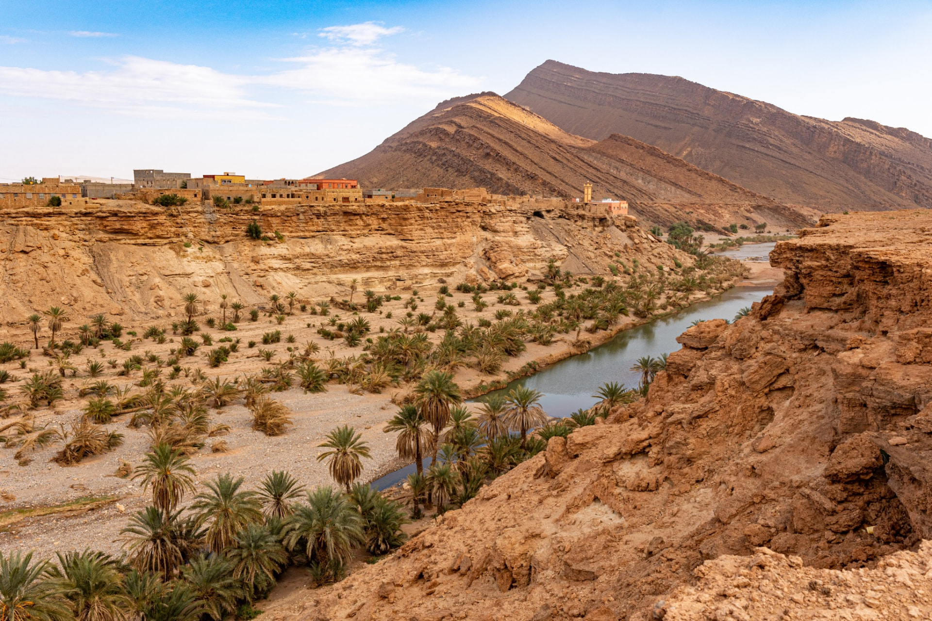
The oldest and most austere range, south of the High Atlas beyond Taroudant and Tafraoute. Pink granite boulders, argan trees, painted rocks, almond blossom in February, fortified collective granaries and villages that see almost no visitors. If you have already travelled Morocco once and want somewhere that feels genuinely unvisited, this is where we would send you — read our companion guides to Amtoudi and the Aït Kine granary.
Where to trek in the High Atlas
There are only a handful of regions most travellers realistically choose between, and they are genuinely different experiences.
Imlil and the Toubkal massif
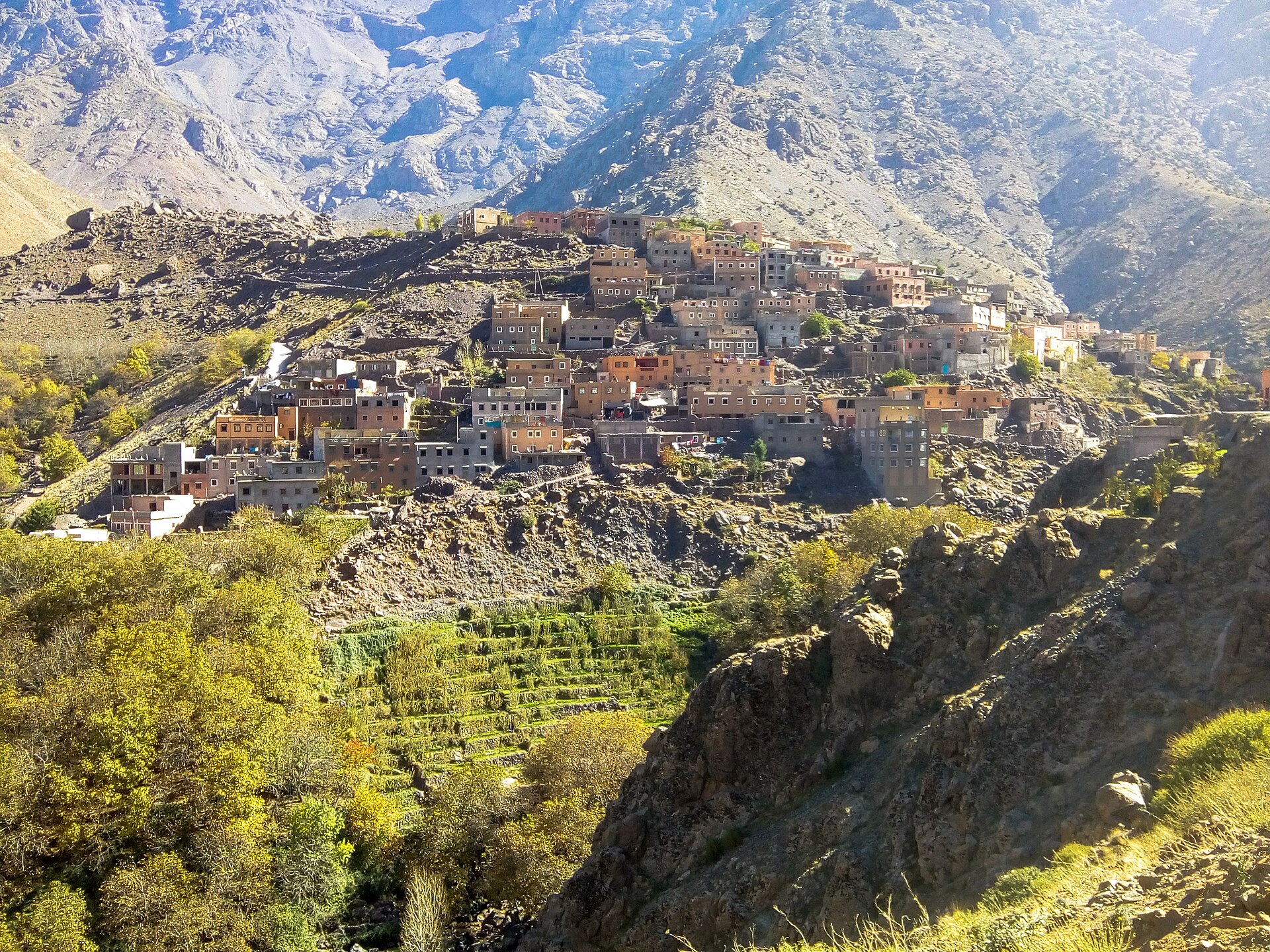
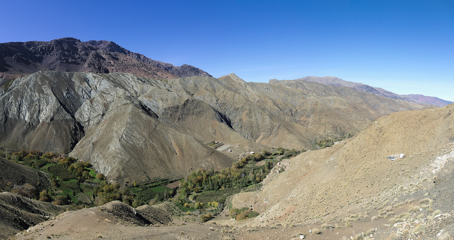
The classic. Imlil sits at around 1,740 metres, about 65 kilometres from Marrakech — an hour and a half by road through the Kik plateau and the Mizane valley. From here you can walk for two hours or for a week. Day walks reach Armed, Tamatert and the shrine of Sidi Chamharouch; longer circuits cross passes into the neighbouring Azzaden and Ouanoukrim valleys; and the Toubkal ascent itself begins here. Imlil has the country's best supply of trained mountain guides, muleteers and mountain lodges, which is exactly why it is busy.
Aït Bouguemez — the Happy Valley
Our favourite for walkers who care more about villages than summits. A wide, flat-floored valley at around 1,800 metres, terraced in green, with earth-built villages on the slopes and the M'Goun massif rising behind. Days here are gentle by trekking standards — three to six hours between hamlets — and nights are in family-run gîtes. It is a long drive from Marrakech (roughly five to six hours), which is precisely why it stays quiet.
The M'Goun massif
Morocco's serious trekking country after Toubkal. Jebel M'Goun is 4,071 metres, and the multi-day traverses through the gorges and high pastures of the Tessaout and Arous are as fine as anything in the range. This is for travellers with real trekking experience and five days or more.
The Ourika and Setti Fatma valleys
The nearest mountain country to Marrakech, 40 minutes to an hour away. Riverside restaurants, waterfall walks, Berber markets, argan and saffron cooperatives. Extremely popular at weekends with Marrakchis, which is part of its charm and all of its traffic. Perfect for a half day; too domesticated for a week.
The Azzaden valley
One valley west of Imlil and a fraction as busy. A beautiful two- or three-day walk links the two over the Tizi Mzik pass, with a night in a mountain lodge at Tizi Oussem. This is the route we recommend most often to travellers who want a proper taste of Atlas trekking without committing a week.
Climbing Jebel Toubkal: the honest version
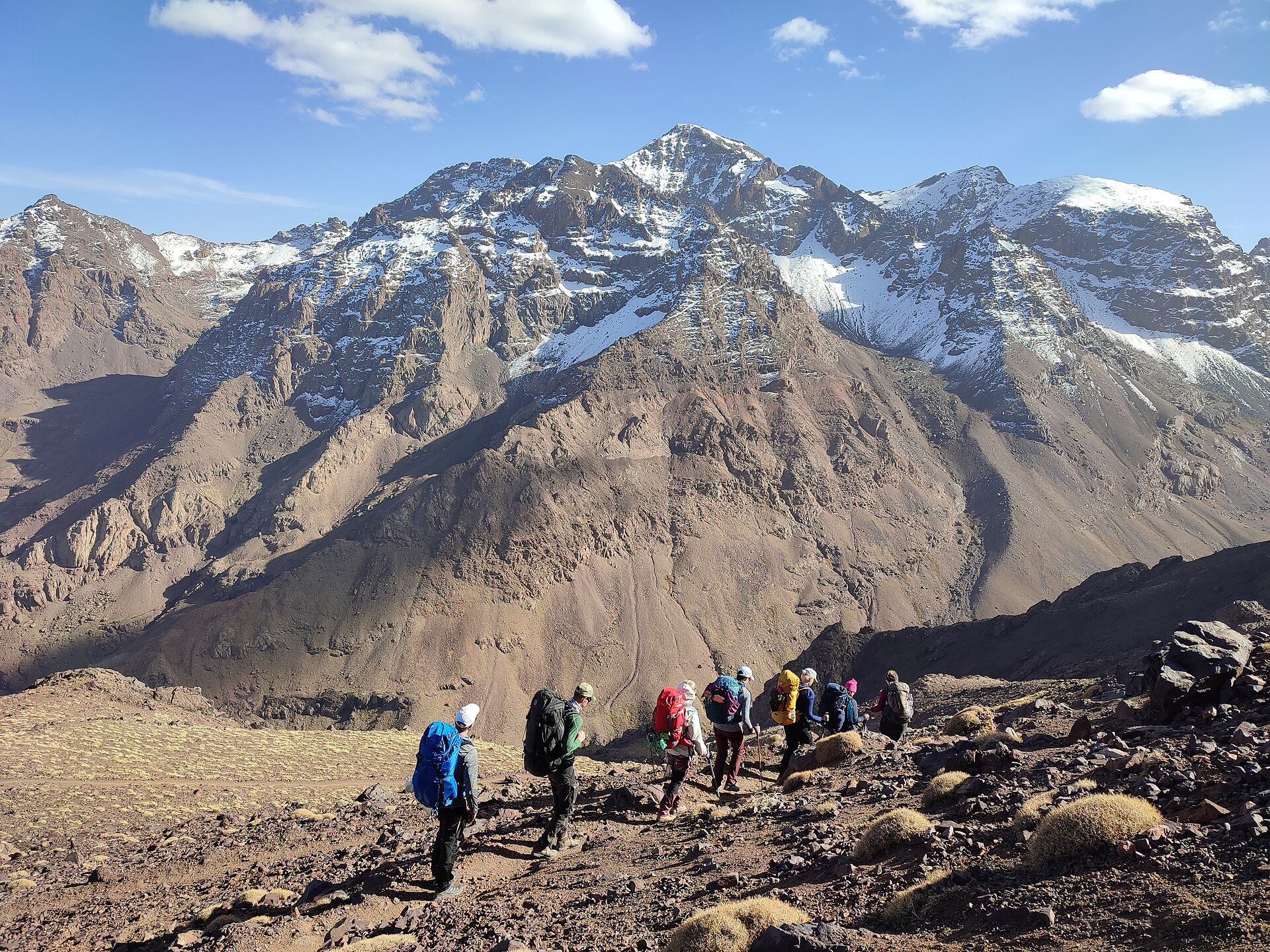
Toubkal, 4,167 metres, is the highest mountain in North Africa and the Arab world. It is a walk, not a climb: there is no technical rock or rope work on the standard south cirque route in summer conditions. It is also long, steep, high, and much harder than most people expect.
The standard two-day itinerary
Day 1 — Imlil (1,740 m) to the refuges below the summit at around 3,200 metres. Roughly 11 kilometres and five to six hours of steady uphill, passing Aroumd and the shrine at Sidi Chamharouch. Mules carry the bags; you carry a daypack. Afternoon and evening at the refuge to acclimatise, eat early and sleep badly, as everyone does at altitude.
Day 2 — a pre-dawn start for the summit, three to four and a half hours of scree and boulder-field walking to the top, then back down to the refuge for lunch and on down to Imlil, arriving late afternoon. Total descent day: eight to ten hours on the legs.
Should you take three days?
If you have the time, yes. A three-day version adds an acclimatisation walk or a night in Imlil first, and the summit success rate and, frankly, the enjoyment both rise sharply. Travellers arriving straight from sea level and attempting Toubkal within 48 hours are the ones who turn back.
Difficulty and fitness
You do not need technical skills. You do need to be able to walk uphill for five or six hours carrying a daypack, on consecutive days, and to cope with thin air. Altitude sickness is the real limiting factor above 3,000 metres — headache, nausea, poor sleep — and it is unrelated to how fit you are. Go slowly, drink far more water than feels necessary, and be willing to stop.
Seasons on the summit
June to September is the straightforward walking season. April, May and October are beautiful but can hold snow high up. From roughly November to April the summit is a winter mountain: crampons and ice axe, with a guide qualified for winter conditions. Many travellers who reach the refuge in winter and turn back there have still had a magnificent trip.
Guides and permits
Moroccan regulations require trekkers on Toubkal to walk with an accredited mountain guide, and independent of the rules it is the right call: guides know the weather, the snowline, the refuge system and the fastest way down if something goes wrong. Accredited guides carry a national mountain-guide card. Arrangements and the current requirements are handled for you on an organised trek; our own Atlas trekking journey is built this way.
Atlas Mountains day trips from Marrakech
Not everyone wants to trek, and the Atlas repays a single well-planned day. The four we recommend most:
- Imlil and the Toubkal foothills — drive 90 minutes, walk two to four hours through walnut groves and villages, lunch on a terrace with the high peaks in view, return by evening. The most mountain for the least effort.
- Ourika valley and Setti Fatma — 40 minutes out, a riverside lunch and the seven waterfalls walk. Best early on a weekday; skip Sunday.
- Ouzoud waterfalls — two and a half to three hours each way, to a 110-metre cascade in the Middle Atlas foothills with wild macaques in the olive groves. A long day, but the single most spectacular natural sight within reach of Marrakech.
- The Kik plateau, Asni and Lalla Takerkoust — the gentlest version: mountain views, a Berber market day if you time it, and a lakeside lunch, with barely two hours of driving in total.
A day in the mountains also pairs beautifully with a slow city morning — see our private experiences for the cooking, artisan and medina half-days we run in Marrakech.
Crossing the Atlas: Tizi n'Tichka and Tizi n'Test
Most travellers meet the High Atlas first as a road, not a trail, and the crossing is one of the great drives in Morocco.
Tizi n'Tichka (2,260 m) carries the main Marrakech–Ouarzazate road. Rebuilt and widened over recent years, it is now a comfortable three to four hours with stops, climbing through argan and walnut country into bare rock and switchbacks, then dropping into the pre-Sahara. The detour to Aït Ben Haddou sits just beyond the pass, which is why almost every desert route uses it.
Tizi n'Test (2,092 m) is the older, narrower, far quieter road to Taroudant, past the 12th-century Tin Mal mosque. It is slower and not for nervous passengers, but the views west are extraordinary. Both passes can close briefly in winter snow; on a private journey your driver simply reroutes.
When to go: a season-by-season guide
- March to May — the finest trekking season. Wildflowers, meltwater in the rivers, green terraces, snow still bright on the peaks. Nights are cold; days are perfect. Lower valleys are at their most beautiful in April.
- June to August — the summit season for Toubkal, and the moment when the mountains become the coolest place in Morocco. Valley floors can still be hot by afternoon; start early. August brings Moroccan holiday crowds to Ourika and Ouzoud.
- September to November — our own favourite. Stable weather, clear light, walnut and apple harvests in the villages, thinning crowds. By November the high passes feel wintry.
- December to February — snow country. Village walks, Imlil in the cold, Oukaïmeden's small ski area, and serious winter mountaineering on the summits. Low-altitude valley trekking remains excellent on clear days.
What to pack for the Atlas
Mountain weather changes fast, and the difference between a valley floor at midday and a pass at dawn can be twenty degrees.
- Broken-in walking boots with ankle support — paths are stony, loose and steep.
- Layers: a base layer, a fleece or light down, and a genuinely windproof and waterproof shell.
- Sun hat, sunglasses and high-factor sun protection. Altitude sun is fierce even when the air is cold.
- Warm hat and gloves for anything above 3,000 metres, in every season.
- A two-litre water capacity and purification for longer treks.
- Head torch for refuge nights and pre-dawn starts.
- A small first-aid kit, blister plasters and any personal medication.
- Cash in small dirham notes — there are no cash machines up the valleys.
- Modest clothing in villages: shoulders and knees covered is the norm, and it is appreciated.
Guides, mules and mountain lodges
Atlas trekking runs on a long-established local system, and understanding it makes the experience richer. An accredited mountain guide leads the route and is responsible for safety. A muleteer and his mules carry the bags, the food and sometimes a tired walker, moving ahead to the next stop. In many villages a cook travels with the group, which is why food on a Moroccan trek is startlingly good for something made on a gas ring at 3,000 metres.
Nights are spent in gîtes d'étape — family-run village lodges, usually simple, warm, with shared bathrooms and a tagine on the table — or in the Toubkal refuges, which are dormitory mountain huts. On the routes we operate, this whole chain is local: guides, muleteers and gîtes from the valleys you are walking through, paid properly and directly. That, more than anything else, is what keeps mountain families in the mountains.
The people of the Atlas
The Atlas is Amazigh — Berber — country, and Tachelhit or Tamazight, not Arabic, is the first language of most villages. The mountain economy has always been a mixture of terraced farming, walnut and apple orchards, livestock moved to high pastures in summer, and now tourism and remittances. Villages are built of stone and rammed earth on the shaded side of a valley so the fertile floor stays under crops.
Hospitality is not performance. If you are invited in for mint tea, the right answer is yes, and the right gesture is time rather than money. Ask before photographing people, especially women. Learn azul for hello and tanmirt for thank you, and watch what they do to your welcome.
Responsible trekking in the mountains
The High Atlas is fragile: thin soils, scarce water, and communities living close to the margin. Small choices matter enormously.
- Carry out every scrap of rubbish, including fruit peel and tissue.
- Use village gîtes and local cooperatives rather than bringing everything from the city.
- Never give sweets or money to children — it teaches begging and keeps them from school. Give to the village school or association instead if you want to help.
- Keep to established paths and terraces; a shortcut across a crop is someone's year.
- Use water sparingly; in many villages it is carried or piped from a single spring.
- Pay guides and muleteers fairly and tip in cash, directly.
Fitting the Atlas into a longer Morocco route
The mountains are not a detour from Morocco; they are the hinge of it. A few shapes that work:
- Two days from Marrakech — Imlil, a valley walk, one night in a mountain lodge, back to the city. Fits inside almost any itinerary.
- Three to four days trekking — Azzaden and Imlil circuits, or the Toubkal ascent, before continuing south.
- Mountains and desert together — walk the Atlas, cross Tizi n'Tichka, and sleep in the dunes a day later. The contrast between 3,000 metres of rock and the silence of the Sahara is the single best two-part journey in Morocco.
- Inside a two-week route — the Atlas, the Draa or Dades valleys and the desert can all sit within a longer Morocco tour package that also takes in Fes, Marrakech and the coast.
Travellers with children often assume the mountains are off-limits. They are not — short valley walks, mule rides and village lunches work beautifully from about five years old; see our Morocco family tours guide for how we pace those days.
Frequently asked questions
Are the Atlas Mountains worth visiting?
Yes — for most travellers they are the memory that outlasts the cities. They are also unusually accessible: real 4,000-metre mountains beginning 90 minutes from Marrakech, with villages, guides and lodges that make a single day or a full week equally possible.
How far are the Atlas Mountains from Marrakech?
The first foothills are around 40 minutes away at the Ourika valley. Imlil, the main trekking base, is about 65 kilometres and an hour and a half by road. Ouzoud waterfalls are two and a half to three hours, and the Tizi n'Tichka crossing takes three to four hours to Ouarzazate.
Can you visit the Atlas Mountains on a day trip?
Easily, and many travellers do. Imlil with a two-to-four-hour walk is the best mountain day; Ourika is the shortest; Ouzoud is the most spectacular but the longest drive. A private vehicle makes all three far better, because you set the start time and avoid the coach schedule.
How hard is the Toubkal trek?
Physically demanding but not technical in summer. Expect five to six hours uphill on day one, a three-to-four-and-a-half-hour summit push from the refuge, and a long descent. Good general fitness, previous hill walking and a sensible attitude to altitude are what matter.
Do you need a guide to trek in the Atlas?
For Toubkal, yes — an accredited mountain guide is required and strongly advisable. For valley walks around Imlil, Ourika or Aït Bouguemez a guide is not always mandatory, but paths are unmarked and a local guide turns a walk into an introduction to the villages you pass through.
What is the best time of year for Atlas trekking?
April to June and September to October for valley trekking, June to September for the Toubkal summit without winter equipment. Winter is magnificent at low altitude and a serious mountaineering proposition high up.
How cold does it get in the Atlas Mountains?
Valley nights drop close to freezing from November to March, and the high refuges and summits go well below it. Even in July, dawn at 3,200 metres is cold. Pack warm layers in every season.
Is there snow in the Atlas Mountains?
Yes. Snow generally lies on the highest peaks from December to April, and sometimes into May, with the small ski area at Oukaïmeden operating in good winters. Snow can briefly close the high road passes.
Is trekking in the Atlas safe?
It is, with normal mountain sense. The genuine risks are altitude, weather changing quickly, dehydration and loose ground underfoot — all of which a good guide manages. Walk with someone accredited, tell someone your route, and do not attempt the summit on a tight schedule.
Can you combine the Atlas Mountains with the Sahara?
Yes, and it is the classic Moroccan combination. Two or three days in the mountains, then the crossing of Tizi n'Tichka and the drive south through the Draa or Dades valleys puts you in the dunes the following evening.
Are the Atlas Mountains suitable for children?
Short valley walks are, from roughly five years old, especially with mules for tired legs and a lunch stop built in. High-altitude trekking and the Toubkal ascent are not suitable for young children.
Where do you sleep when trekking in the Atlas?
In village gîtes — simple family-run lodges with shared bathrooms and home cooking — or in the mountain refuges below Toubkal, which are dormitory huts. A few valleys also have small mountain hotels for travellers who want private bathrooms between walking days.