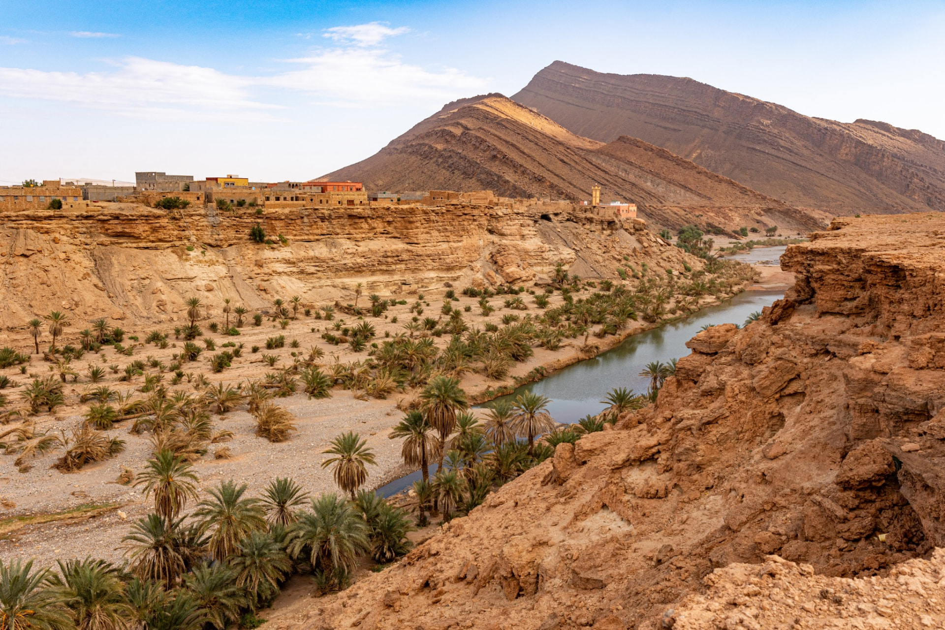
Amtoudi sits at the point where the Anti-Atlas stops being a range of dry brown hills and becomes something far stranger: a narrow palm valley cut into limestone, with fortified granaries perched on the cliffs above it. It is one of the few places in southern Morocco where landscape, architecture and village life still explain each other. The water made the oasis possible, the oasis made the harvest worth defending, and the granaries above the palms are what defence looked like before there were banks, police posts or roads.
This guide is written for travellers who want to understand Amtoudi rather than tick it off. It covers where it is and how long the drive really takes, what the granaries are and why they were built where they were, how the gorge walk works, when to come, what to bring, how to visit responsibly in a place where nothing is guaranteed to be open, and how Amtoudi fits into a wider Anti-Atlas or southern Morocco route.
Where Amtoudi is, and why that matters
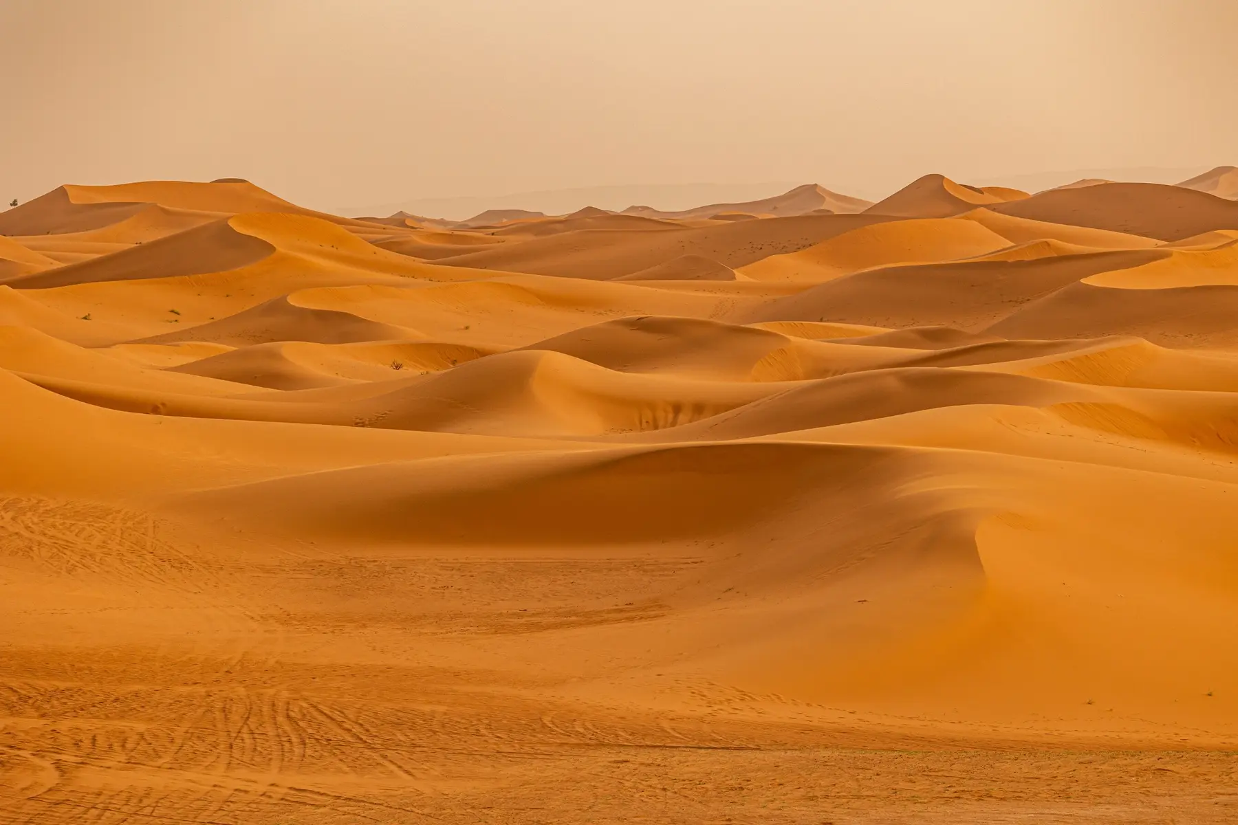
Amtoudi (also written Id Aïssa, after the best-known of its granaries) lies in the Anti-Atlas of southern Morocco, inland from the Atlantic coast and roughly between Guelmim to the south-west and Tafraoute and Tata to the north and east. It is a mountain-oasis village, not a desert village: the sand seas of the Sahara are further east and south, and Amtoudi's character comes from rock, spring water and date palms rather than dunes.
Its position is the whole story. The valley is fed by water emerging from limestone, which allowed a permanent settlement in an otherwise arid range. That water supported palms, cereals and gardens; those harvests attracted risk; and the cliffs offered natural defence. Everything you see in Amtoudi is an answer to that sequence.
Realistic travel times
Distances in the Anti-Atlas are misleading. Roads are mountainous, single-carriageway in most places, and slow by design rather than by fault. Plan in half-days, not hours:
- From Guelmim or the Agadir–Sidi Ifni coastal area: a substantial half-day of driving each way, on winding roads once you leave the plain.
- From Tafraoute: a full day when travelled as a scenic route, because the interest is in the passes, the granite country and the villages on the way.
- From Tata or the Aït Kine area: a long connecting day through the southern Anti-Atlas, best broken with stops rather than driven straight.
- From Marrakech or Agadir directly: not a day trip. Amtoudi needs at least one overnight in the region to be worth the driving.
The final approach into the valley is on a smaller road, and conditions can change after rain. We travel this region in a private 4x4 with a driver-guide who knows the current state of the tracks; that is the practical difference between arriving relaxed and arriving frustrated.
The granaries: what an agadir actually is
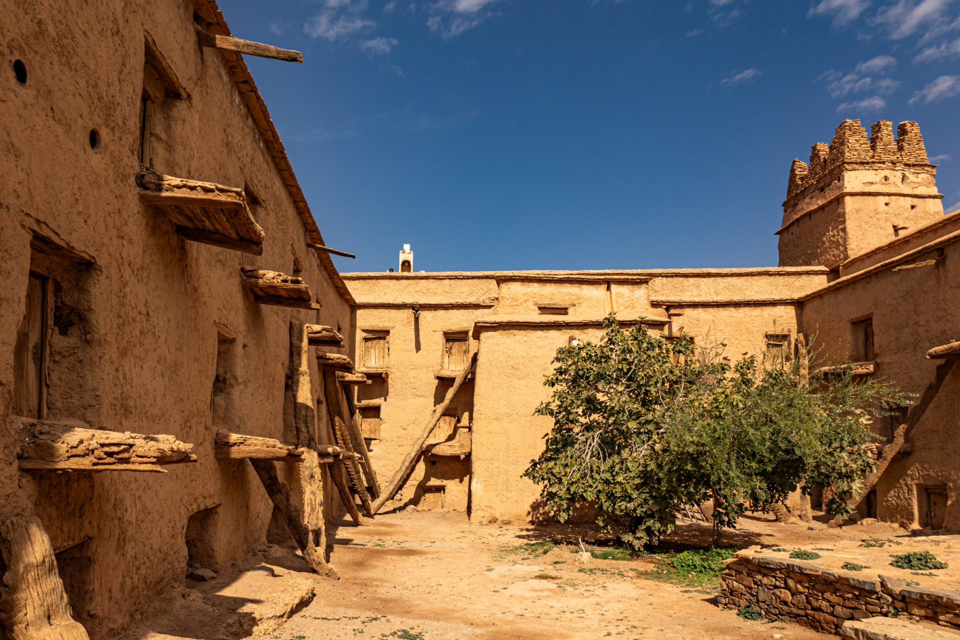
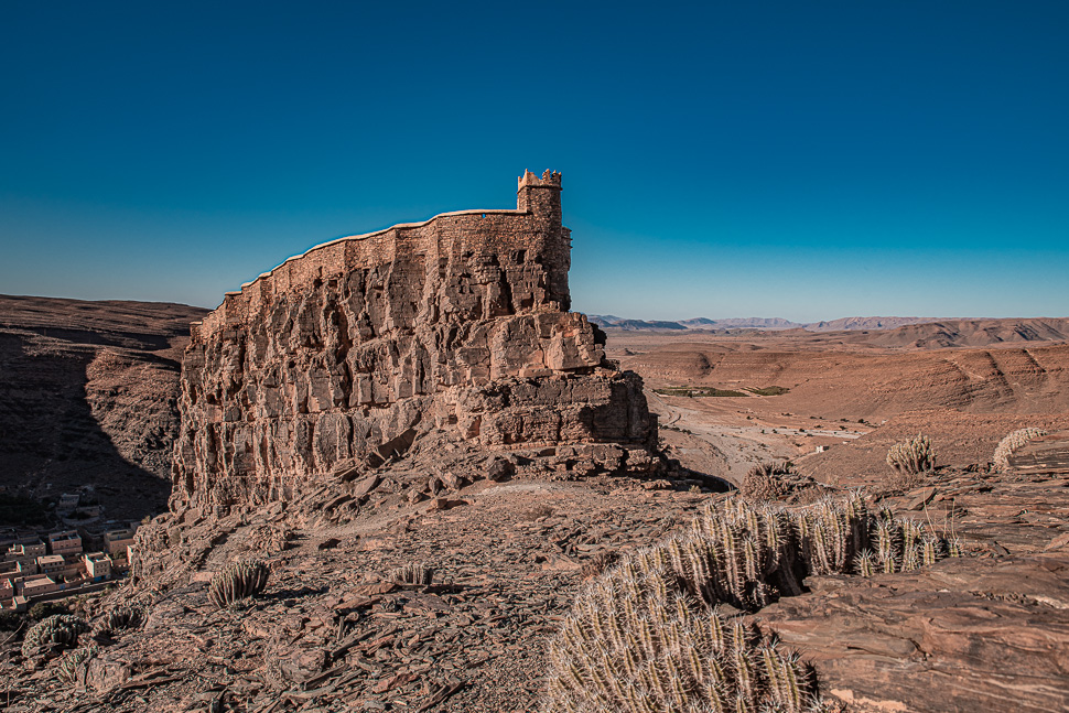
In Amazigh architecture an agadir (plural commonly written igoudar) is a fortified collective storehouse. It is not a castle, not a palace and not a religious building, although it is often mistaken for all three. It is closer to a communal strongroom: a defended structure containing dozens of small individual chambers, each belonging to a family, governed by shared rules and watched over by an appointed guardian.
Inside those chambers families kept grain and seed, but also oil, dates, almonds, dried food, textiles, jewellery and written documents — marriage contracts, land agreements, family papers. In a region where a bad harvest or a raid could end a household, the agadir protected food security, property rights and memory in the same building.
Amtoudi is known for its granaries because of their setting and their state of preservation. The most visited, generally called Agadir Id Aïssa, stands high on a rock spur above the valley, reached by a stepped path; a second, lower granary sits on the opposite side of the valley and is easier to reach. Both share the same logic: high ground, a single controlled entrance, thick walls of stone and earth, and a dense honeycomb of storage cells inside.
Reading the architecture
A few details are worth looking for, because they turn a ruin into a document:
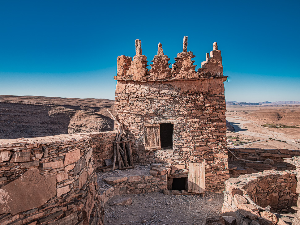
- The approach path. Deliberately narrow and exposed. Access was meant to be slow and visible.
- The gate. Usually a single heavy wooden door, often with a hand-cut lock mechanism. Control of the door was control of the institution.
- Cell doors. Small, low and individually secured. Their size is not decorative; it limited how much could be removed at once.
- Water storage. Cisterns collected rainfall so the structure could hold out when the valley below could not.
- Repair layers. Earthen buildings are maintained continually. Different mortars and stonework record generations of upkeep, not carelessness.
Dating these buildings precisely is difficult, and it is more honest to speak in centuries than in years. Repeated repair is part of how they survive, which means a wall may be old in conception and recent in fabric at the same time.
Geology and the oasis landscape
The Anti-Atlas is among the older mountain systems in North Africa, and around Amtoudi the rock is largely limestone — soluble, fractured, and therefore capable of storing and releasing water. That is why a spring-fed valley exists here at all. Rainfall on the high ground percolates through the rock and re-emerges lower down, sustaining a narrow ribbon of palms, small irrigated plots and, in places, permanent pools.
The gorge itself is the most photographed part of Amtoudi and the most rewarding to walk. Walls rise steeply on both sides; the floor alternates between palm groves, gardens divided by earth channels, boulder fields and stretches of water depending on the season. Barbary ground squirrels are common; birds of prey are frequently seen along the cliff line. Water levels vary enormously through the year and after rain, so the valley you photograph in April is not the valley someone else photographed in September.
Walking in Amtoudi
There are broadly three kinds of walk, and they suit very different people.
1. The gorge walk
Following the valley floor upstream from the village is the gentlest option: mostly flat, shaded in parts by palms, with the cliffs closing in as you continue. It can be a short stroll of under an hour or a half-day out-and-back, depending on how far you go. Footing is uneven in places and can be wet or slippery where water is present.
2. The climb to the upper granary
The path to the high granary is a steady ascent on stone steps and rock, and it is genuinely steep in sections. Most reasonably fit travellers manage it at a slow pace with breaks; it is not a technical climb, but it is exposed to sun and there is no shade on the way up. Allow far more time than the distance suggests, and treat the descent with the same care as the climb.
3. Longer walks around the valley
Beyond the two main objectives there are village paths, irrigation channels and higher viewpoints that reward an unhurried day with a local guide. Walking with someone from the village is also the most reliable way to understand what you are looking at, and it keeps the value of your visit in the community.
The village, and how to visit responsibly
Amtoudi is a working Amazigh village, not a heritage park. Gardens are cultivated, houses are lived in, and the granaries are community property with a long history of custodianship. That has practical consequences for visitors.
- Do not assume access. Whether a granary interior can be entered depends on the custodian being present and willing. There is no published, guaranteed opening schedule, and it is unreasonable to expect one. Arrive with a flexible plan and treat interior access as a possibility rather than an entitlement.
- Ask before photographing people. Architecture and landscape are straightforward; residents are not subjects. A short conversation first changes the encounter for both sides.
- Pay for local guiding. Where a guardian, guide or muleteer is available, engaging them is both the courteous and the useful choice.
- Take nothing, move nothing. Loose stones, timber and pottery fragments are part of a fragile structure.
- Carry your waste out. Waste collection in remote valleys is limited; assume there is none.
- Dress with local norms in mind. Covered shoulders and knees are appreciated in a small conservative village, and are also sensible sun protection.
- Respect water. Irrigation channels are agricultural infrastructure, not scenery. Do not wash in them or block them.
When to visit
Amtoudi is a hot-climate mountain valley, and the season changes the experience more than the itinerary does.
- Autumn (roughly October–November): generally the most comfortable combination of walkable temperatures and long light. Our preferred window for pairing Amtoudi with walking.
- Winter (December–February): pleasant days for the climb, cold nights, and the clearest air of the year. Short daylight means earlier starts.
- Spring (March–May): often beautiful, with gardens active and water more likely in the gorge, but conditions vary with the winter rains that preceded it.
- Summer (June–August): genuinely hot, with the granary climb best avoided outside the early morning. Possible, but it narrows what you can do.
Rain is infrequent but consequential: run-off can make the valley floor impassable for a time and can affect the access road. For the wider picture across the country, see our month-by-month guide to the best time to visit Morocco.
What to bring
- Shoes with real grip — the granary path is stone, dust and rock, not a boardwalk.
- More water than feels necessary, plus a way to refill; there is no reliable supply on the climb.
- Sun hat, high-factor sun protection and sunglasses; the limestone reflects hard light.
- A warm layer for evenings and winter mornings; the valley cools quickly after sunset.
- Cash in small notes for guiding, tea and village purchases. Do not count on card payment or an ATM.
- A head torch if you plan an early start, and a small first-aid kit.
- Offline maps: mobile coverage is patchy in the valley and gorge.
How Amtoudi fits into a southern Morocco route
Amtoudi rarely works as a standalone destination, and it is best treated as one strong day inside a wider Anti-Atlas loop. Two shapes work particularly well.
Coast into mountains. Travel down the Atlantic through Essaouira, Agadir and the Sidi Ifni area, then turn inland through Guelmim towards Amtoudi before continuing to Tafraoute. This suits travellers who want contrast — ocean light, then stone. Our Coast collection covers the Atlantic side of that route, and the southern coastal journey is the natural first half.
Anti-Atlas heritage circuit. Link Amtoudi with Tata and the collective granary at Aït Kine, where the same institution can be seen in a still-living form. Travelled together, the two sites make the argument that igoudar were a regional system rather than isolated curiosities.
Either can be extended east towards the desert. If dunes are the other half of your trip, our Sahara journeys pick up naturally from the southern Anti-Atlas, and the Journeys collection shows how longer private routes are built. Slower, culturally focused days can also be paired with our Experiences.
Frequently asked questions
Can I visit Amtoudi as a day trip from Agadir or Marrakech?
Realistically, no. From Agadir it would mean an exhausting there-and-back day with little time in the valley; from Marrakech it is not sensible at all. Amtoudi deserves an overnight in the region.
Will the granary be open when I arrive?
There is no guaranteed schedule. Access to interiors depends on the custodian and on local circumstances, and it can change day to day. The walk, the setting and the exterior architecture are worth the journey on their own; treat interior access as a bonus.
How hard is the climb to the upper granary?
Steep but non-technical: stone steps and rock, exposed to the sun, typically taking well under an hour at a slow, steady pace. Anyone unsure on uneven ground, or travelling in heat, should consider the lower granary and the gorge walk instead.
Is there water in the gorge?
Sometimes. It depends on the season and on recent rainfall, and it varies from year to year. Do not plan a visit around swimming or pools.
Do I need a guide?
Not to walk the valley — but a local guide transforms the visit, and the granaries in particular are far more legible with someone who can explain their use and history.
Where do people stay?
Accommodation in and around the valley is simple and limited. Rather than name properties whose status changes, we arrange lodging appropriate to the route at the time of travel, in the village area or in a nearby town.
Is Amtoudi suitable for children or older travellers?
The gorge walk, yes, for most people. The upper granary climb is a different proposition. A private itinerary can split the group easily, which is usually the best answer.
Plan it properly
Amtoudi rewards travellers who arrive with time, context and a driver who knows the region. If you would like it built into a private Anti-Atlas or southern Morocco route — with the pacing, the seasons and the walking honestly matched to your group — tell us what you have in mind and we will design the route around it.